Stay tuned with what's happening at Jones County Conservation with updates about our latest projects!
Central Park Clean Up and Restoring Landscape
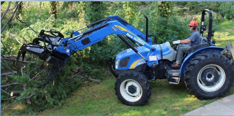
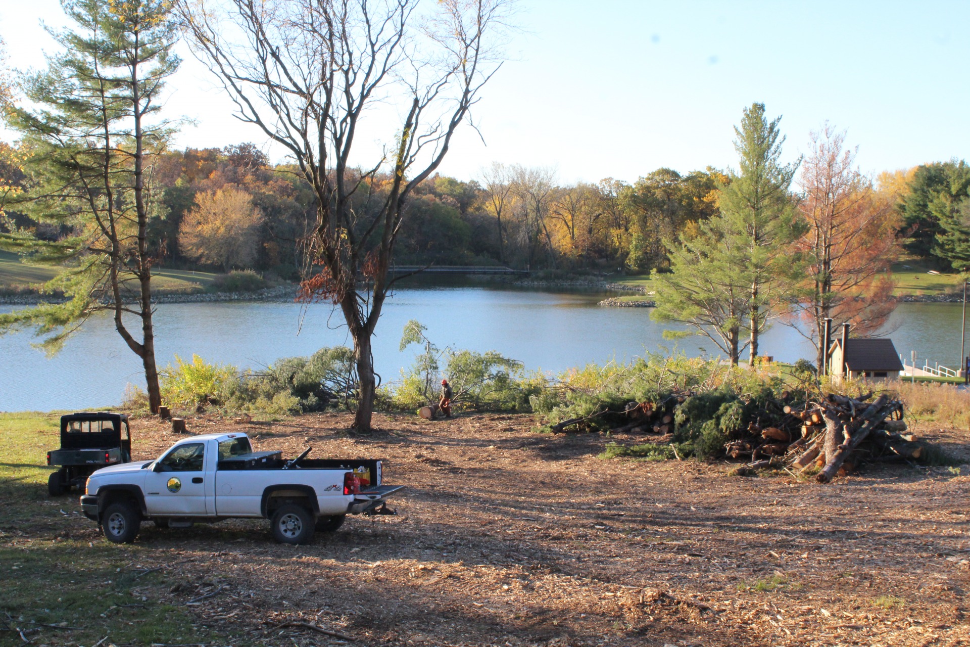
Visitors to Central Park have probably noticed several changes to the landscape within the park including between the lake and the Nature Center, the pine area NW of the Nature Center as well as the area near the maintenance buildings.
Read More
Central Park Clean Up and Restoring Landscape

Visitors to Central Park have probably noticed several changes to the landscape within the park including between the lake and the Nature Center, the pine area NW of the Nature Center as well as the area near the maintenance buildings.
The 2020 Derecho severely damaged trees throughout the park.
Over the last few years, park staff and contractors have worked to clear damaged trees and open up closed trails and sections of the park. Several areas cleared will be restored to native vegetation including prairie and savannah prairie. Keeping pollinators, including the Monarch butterfly in mind, these plantings will include many beautiful native flowers.
Work is done to control erosion in areas where trees were removed with silt fencing, erosion control socks and temporary cover crops. Prairie plantings will take place over the next few years. Work on these areas will be ongoing until completed. In the mean time you can still enjoy Central Park and the beauty it offers. Camp, hike, bike, swim, paddle, or float.

Fremont Bridge at Central Park
The goal of the project is to lengthen the usable life of the historic Fremont Bridge, not only for its magnificent historical quality but also for its attractiveness to park visitors.
Read More
Fremont Bridge at Central Park

The goal of the project is to lengthen the usable life of the historic Fremont Bridge, not only for its magnificent historical quality but also for its attractiveness to park visitors.
Originally built in 1873, the Fremont Mill Bridge spanned the Maquoketa River at Monticello on the Military Road. The Military road started as a trail in 1839 and became Iowa’s first permanent thoroughfare, later named Highway 151. For 57 years it stood to ensure the movement of Iowa’s agricultural goods to market, and the growth of the state’s settlement and economy. From there it was moved to serve another river crossing west of Anamosa near the Fremont Mill site on the Buffalo River. For another fifty-five years (1930-1985) it meet the transportation needs of the local community. It was then moved to its current location at Central Park.
Since 1985 this bridge has stood as a symbol of Iowa’s rich history, drawing young and old to study its intricate double-plated lattice arching design. From its beautiful arches visitors are able to peer into the lake below with its many unsuspecting fish, turtles, and frogs swimming by. Maintaining these opportunities for years to come will help to draw many more generations to the park. During a time of busier and busier lifestyles attracting people outdoors is a vital component in improving the health and vitality of our friends, relatives and neighbors.
In 2023 a new timber deck was installed with a new chain link fence along with some mobilization work. Future repairs to the bridge will occur as funding is secured.

Eby’s Mill Wildlife Area Access
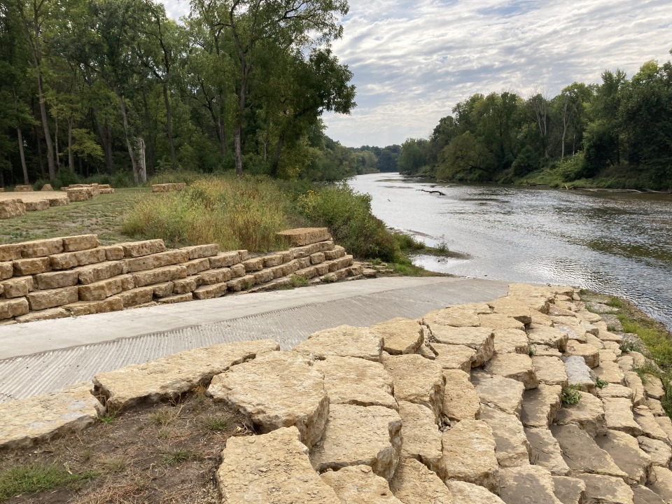
Completion of the Eby’s Mill River Access has opened the door to a large section of the Maquoketa River. As a picturesque, major river flowing through Jones County, the Maquoketa has never had two hard surface access points connected within the county. Hard surface access points assist river enthusiasts with accessing the water with their boating equipment, in addition to providing a stable site for safely entering and exiting their equipment. Pictured Rocks to Eby’s Mill is the stretch of river with increased accessibility. Both now contain a hard surface ramp (Pictured Rocks – local quarried stone, Eby’s Mill – concrete) and stabilized shoreline to allow safe usage during a large variety of river levels. In addition to a new ramp, Eby’s Mill now also contains 9 vehicle-trailer or vehicle-vehicle parking spots, and 25 single vehicle parking spots. Overflow parallel parking is also available along the entry drive. Two of these parking locations are handicap accessible – one vehicle-trailer and one single vehicle. All are connected to the ramp with an informational kiosk via a sidewalk. The kiosk shows maps of the area, images of local game fish, rules and regulations, and the tremendous group of donors it took to make the new access possible, including: Thomas Barry III, Matt and Beth McQuillen, Ohnward Bank and Trust, Chris Nelson, Wade Wamre, the Jones County Board of Supervisors, DNR Water Recreation Access Cost-Share Program, DNR Water Trail Development Program, and the Grant Wood Loop.
Read More
Project Details
Eby’s Mill Wildlife Area Access

Completion of the Eby’s Mill River Access has opened the door to a large section of the Maquoketa River. As a picturesque, major river flowing through Jones County, the Maquoketa has never had two hard surface access points connected within the county. Hard surface access points assist river enthusiasts with accessing the water with their boating equipment, in addition to providing a stable site for safely entering and exiting their equipment. Pictured Rocks to Eby’s Mill is the stretch of river with increased accessibility. Both now contain a hard surface ramp (Pictured Rocks – local quarried stone, Eby’s Mill – concrete) and stabilized shoreline to allow safe usage during a large variety of river levels. In addition to a new ramp, Eby’s Mill now also contains 9 vehicle-trailer or vehicle-vehicle parking spots, and 25 single vehicle parking spots. Overflow parallel parking is also available along the entry drive. Two of these parking locations are handicap accessible – one vehicle-trailer and one single vehicle. All are connected to the ramp with an informational kiosk via a sidewalk. The kiosk shows maps of the area, images of local game fish, rules and regulations, and the tremendous group of donors it took to make the new access possible, including: Thomas Barry III, Matt and Beth McQuillen, Ohnward Bank and Trust, Chris Nelson, Wade Wamre, the Jones County Board of Supervisors, DNR Water Recreation Access Cost-Share Program, DNR Water Trail Development Program, and the Grant Wood Loop.
https://www.jonescountyiowa.gov/news/improvements_made_to_ebys_mill_river_access/#gallery-1
Wapsi Trail
Phase II of the Wapsipinicon Trail is completed! The financial, vocal, and grassroots support that people have provided to the trail made the difference.
Read More
Project Details
Wapsi Trail

Phase II of the Wapsipinicon Trail is completed! The financial, vocal, and grassroots support that people have provided to the trail made the difference.
Since the completion of Phase I, it has been great to see just how many people are already enjoying the opportunity to get outdoors and go for a run, walk, or bicycle ride on the completed portion.
The local construction firm Boomerang Construction lead the development while Shive Hattery Architecture and Engineering assisted with construction oversight. The trail connects the City of Anamosa to the Hale Bridge and Wapsipinicon State Park via a ten foot wide concrete trail.
Projects like this add to our collective Quality of Life and it is great to be a part of such a strong group of partners assisting in a singular and truly exhilarating cause.


